
| Historic
Watershed Maps |
|
| Activities |
|
| you are here: home >areas of interest/concern > Burke's Spring > Burke's Spring (page 2) | |
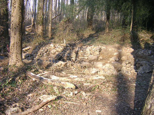
The springhouse foundations are constructed of local quartz, carefully fit together with a minimum of mortar. The overall 10-foot by 30-foot outline of the springhouse was roughly rectangular, but the section of the foundation farthest away from the spring, visible at the right in the picture below, is rounded and quite deep, and may have been used as an icehouse. The spring itself is at the far left in this picture, near the barely-visible pink surveying flag.
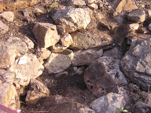
Here's a more detailed view of the circular section of the foundation:
To follow the spring's path as it emerges from under the springhouse foundations, go to page 3.
|
|
| Home | Watershed Map & Areas of Interest/Concern |
Historic Watershed Maps | Activities | Contact/Join Us |
All items copyright © 2003-2005
Friends of Burke's Spring Branch unless another source is noted.
Copyright for items with identified authorship remains with the
author(s); historical and other documents reproduced here are, to
the best knowledge of the webmaster, in the public domain. Items
under Friends of Burke's Spring Branch copyright may be reproduced
for nonprofit research or educational use as long as this copyright
notice is included. Please direct comments and questions to Cathy
Saunders. |