
Erosion from Stockwell Manor Site --
October 7 & 8, 2005
| Home | |
| Who We Are | |
| Historic
Watershed Maps |
|
| Activities |
|
| you are here: home > | |
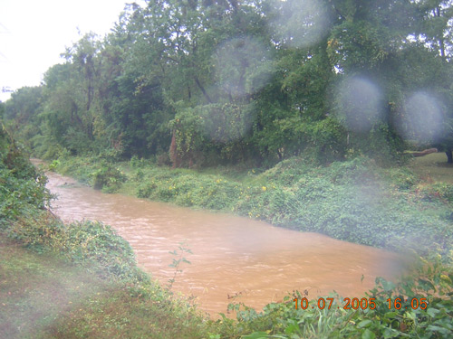
On the afternoon of October 7, 2005, it had been raining for several hours, and the flow in Pimmit Run where it crosses under Westmoreland St. was not only high, but also of an unusual orangey-brown color, suggesting the stream might be carrying sediment eroded from our local red-clay subsoil:
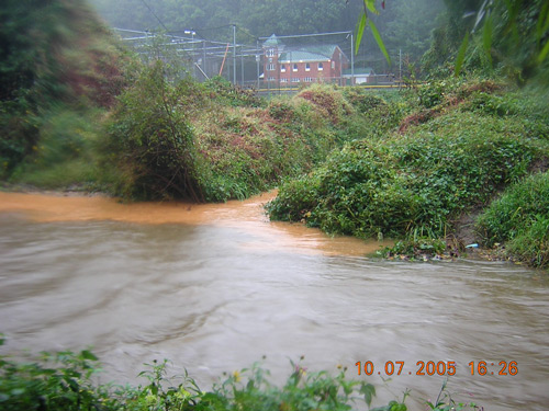
A few hundred yards upstream, the source of the orange color became clear; it was emanating from the mouth of Burke's Spring Branch:
Where was the sedimented water coming from? And how serious a problem was it? Investigation upstream, and in the days to follow, would show. If you're not familiar with the Burke's Spring Branch watershed, you may also want to consult our map |
|
| Home | Watershed Map & Areas of Interest/Concern |
Historic Watershed Maps | Activities | Contact/Join Us |
All items copyright © 2003-2005
Friends of Burke's Spring Branch unless another source is noted.
Copyright for items with identified authorship remains with the
author(s); historical and other documents reproduced here are, to
the best knowledge of the webmaster, in the public domain. Items
under Friends of Burke's Spring Branch copyright may be reproduced
for nonprofit research or educational use as long as this copyright
notice is included. Please direct comments and questions to Cathy
Saunders. |